OurGlobalAdventure

Heather and Darren's Travels

Tag: Hiking

Antelope Island Hike

6 miles is a not insubstantial hike, especially when it involves a climb of 2,000 feet.  Pertinent to mention is starting at an elevation of 4,500 feet. I only noticed one person huffing and puffing more than me and his excuse was carrying a smug toddler in one of those baby carrying contraptions on his back.

Kitted up in our hiking boots with fleeces and gloves, woolly hat at the ready, we were surprised to see many fellow hikers with just shorts and t shirts. I kid you not, I even saw someone wearing a skimpy vest top. Wondering whether they were truly hardcore or just foolhardy, we concluded this must just be a really good weather day for them. After all, there was a promised high of 55 degrees and the sun was almost visible through the streaky haze of clouds.

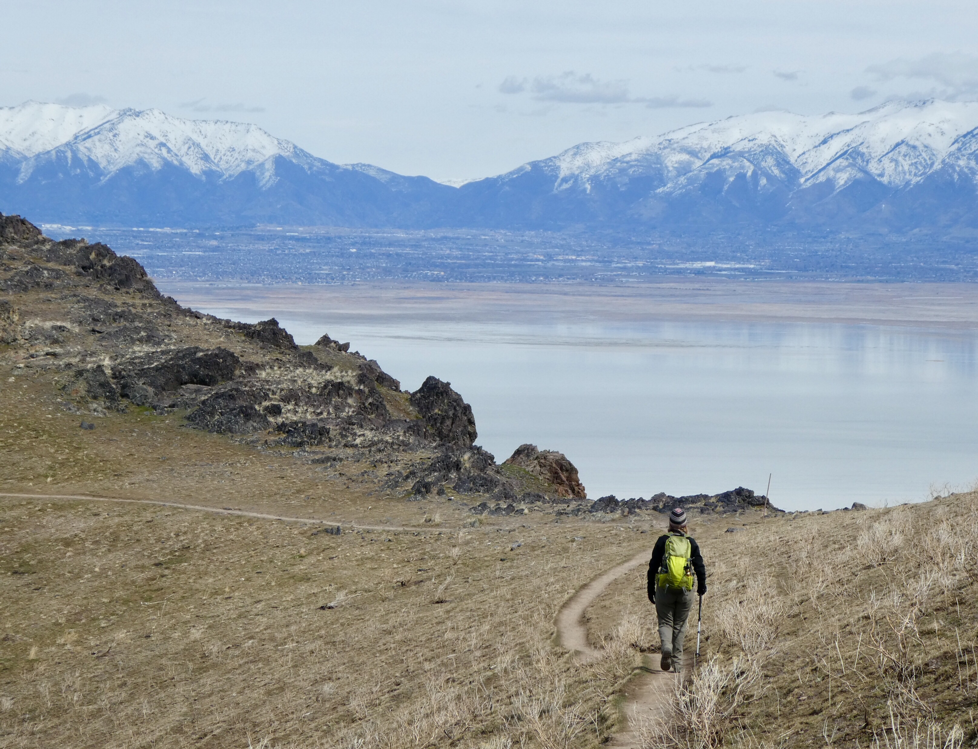
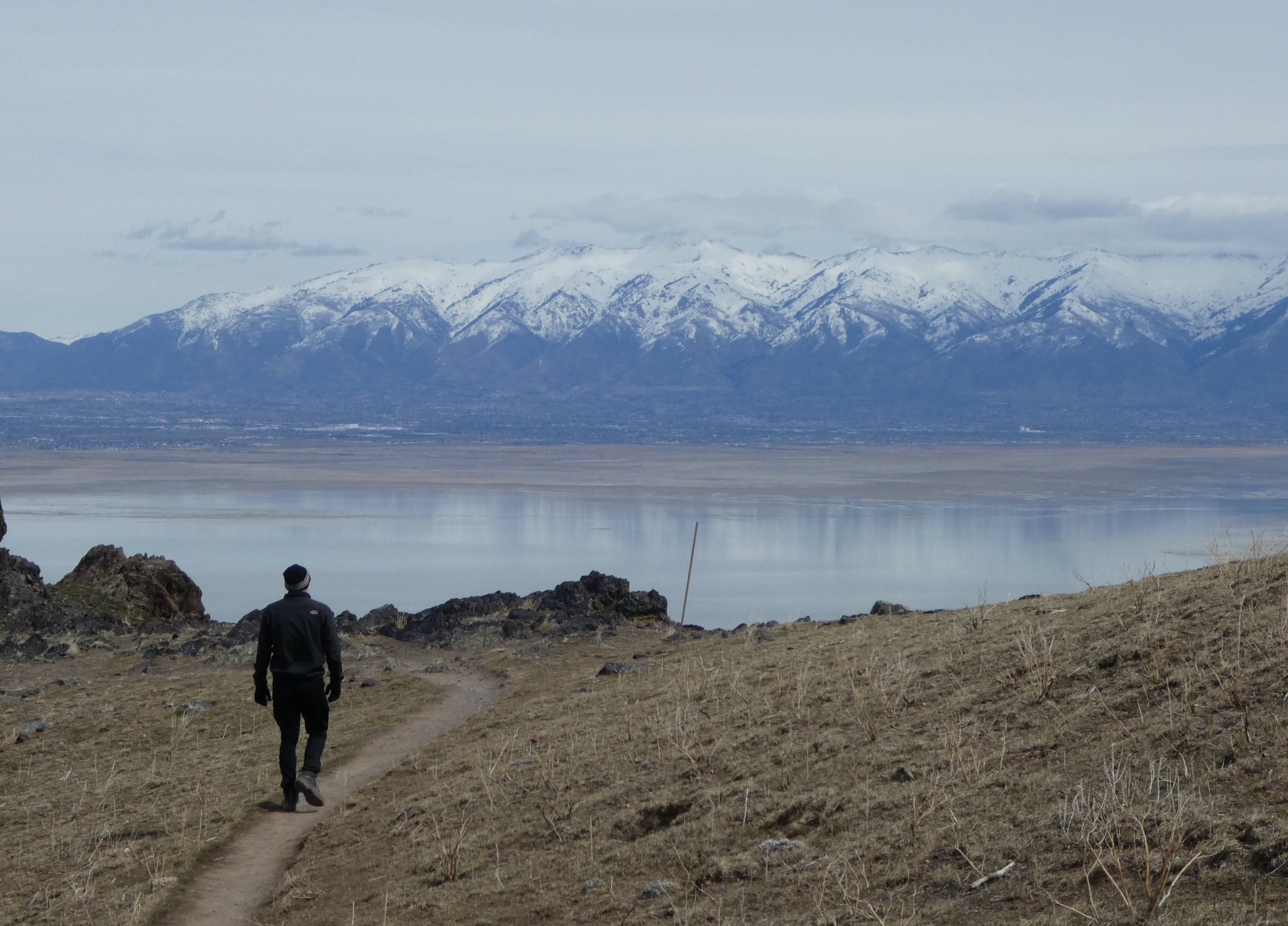
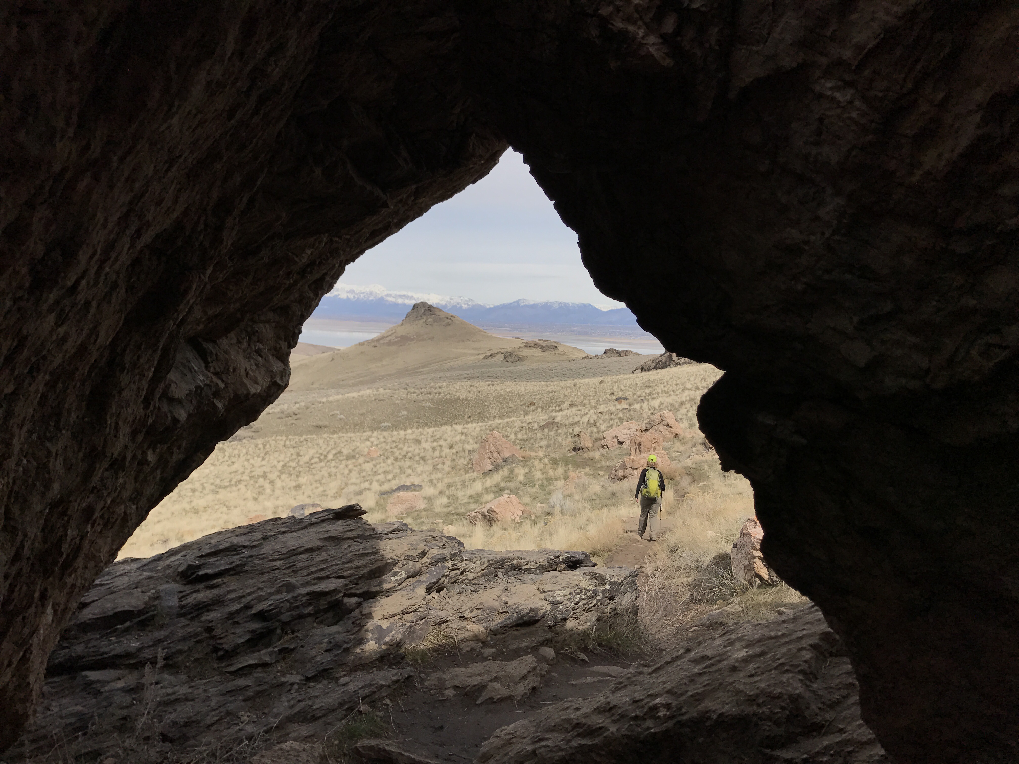
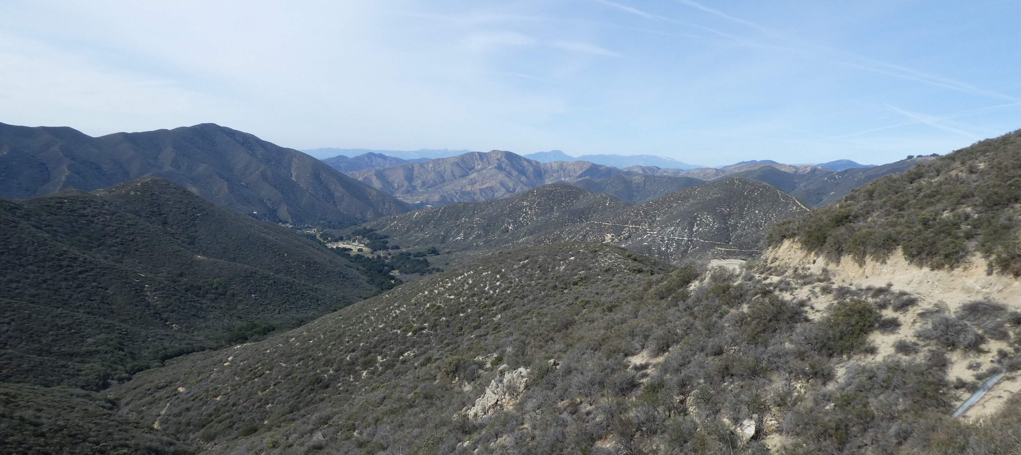
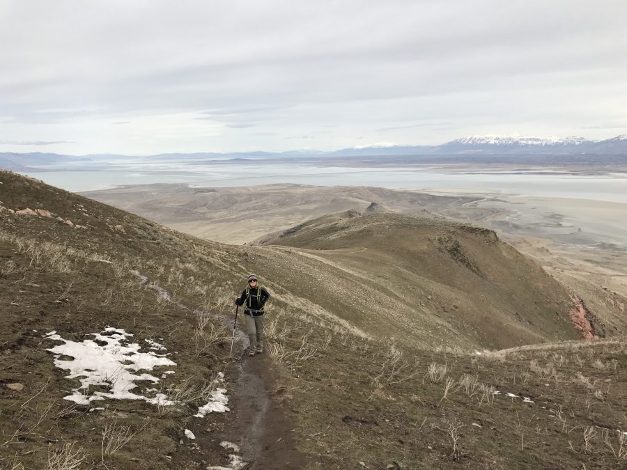
The views throughout propelled this walk into my Top Hikes list, with snow capped mountains reflected in the sometimes clear, sometimes shimmering lake. I particularly liked the way the trail meandered from one side of the ridge to the other, balancing out the views as we climbed higher, until we were treated with a breathtaking 360 degree view from the top of Frary Peak.

An added bonus on the hike was spotting bison. Far below on the grasslands were tiny flecks of brown, barely discernible from the rocks. In fact, there may have been a few false calls, it being difficult to prove one way or the other at that distance.

The combination of trail mix snacks and Werthers Original was inevitably not enough to stave off the talk of potential pizza later and the mile by mile countdown to the curry chicken wrap awaiting us back in the car.  Nom nom.

PCT Gate

You may have heard us mention the PCT or Pacific Crest Trail before.  It’s the long-distance hiking trail that meanders through the western states of the US from the Mexican border in the south to the Canadian border in the north, covering over 2,500 miles.  Whilst I have to rein Darren in a bit with his grandiose ideas of completing the entire trail, I must admit it’s a neat idea to be able to rack up some PCT miles over the years.

As the trail goes virtually right through Santa Clarita, some of the sections closer to home and around Vasquez Rocks have long since been ticked off.  We’ve even done some sections further afield – climbing the Sierras in California, further north in the Cascades, and (so I’m told) we’ve apparently completed sections in Oregon and Washington.  It really does feel like you can’t venture too far without crossing a PCT designated bit of trail, along with its tell tale triangular sign.

Given all the rain we’ve had in Southern California over the last few months, now is a great time to go hiking.  The surrounding mountains are blanketed in shades of green, with the first few early wildflowers starting to make an appearance.  Saturday morning brought us a chilly but bright start, a bit breezy but no rain forecast – so a perfect day to continue our PCT journey.


As we set off from our allotted starting point for our PCT walk, about an hour’s drive from home, the conversation soon turned to food.  What snacks did we have with us, what would we eat later having walked up an appetite, what should we take to eat in the car on our next road trip, that kind of thing.


Not to mention the bigger dilemma of what to take to drink during our next holiday when we are snowshoeing up to a yurt in the middle of nowhere.  Never is the alcohol content to weight ratio more important than when you’re carrying everything you need on your back.

It was only after the half way point of our 10 mile jaunt that I paused to consider the distinct absence of PCT signs.  To be fair, (a) the trail isn’t exactly littered with them and (b) I’m not the most observant of people, so I clung to the hope that I’d just missed the signs and there would be one at the start/end, bold as brass.  Meanwhile, Darren started to look sheepish.  By the time we’d done, feet feeling a little worse for wear after 1,500 feet of climbing, still no sign of a sign.

Back at the ranch, map in hand, Darren concluded that the other path we could see skirting the mountainside – THAT was the PCT.  What we had been on was a fire road running in the same general direction just a few miles up.  Me… I’m resorting to making my own rules.  I mean, what’s the big deal with this PCT thing anyway.  I’m sure I once read something about taking The Road Less Traveled…

Powered by WordPress & Theme by Anders Nor.én Theme mucked about with by Darren, any loss of quality is my fault!